Compiled by Ewa Historian John Bond
Naval Weapons Station Earle
https://en.wikipedia.org/wiki/Naval_Weapons_Station_Earle
Naval Weapons Station Earle is a United States Navy base in Monmouth County, New Jersey, United States. Its distinguishing feature is a 2.9-mile (4.7 km) pier in Sandy Hook Bay where ammunition can be loaded and unloaded from warships at a safe distance from heavily populated areas.
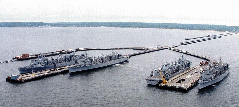
The station's Pier Complex is one of the longest "finger piers" in the world. It is presently comprised of a two mile long trestle which connects to three finger piers - which are Piers 2, 3, and 4. These piers stretch nearly three miles into the Sandy Hook Bay. One mile from the shore the trestle branches off to Pier 1. At the junction of Piers 2, 3, and 4, a concrete platform exits which supports a forklift/battery recharging shop and the port operations building. This area is known as the "wye". All of the existing structures, with the exception of Pier 4 and the "wye", were constructed in the early 1940s. The "wye" was constructed in 1981 and Pier 4 was completed in 1990.
Naval Weapons Station Earle
https://www.globalsecurity.org/military/facility/earle.htm
The Earle Naval Weapons Station, Earle/Leonardo Pier complex, is located along the northern New Jersey shore in the south end of Sandy Hook Bay. It is located 4 miles west of Sandy Hook and 7 miles southeast of Staten Island. The command's name was changed in 1974 from Naval Ammunition Depot to Naval Weapons Station.
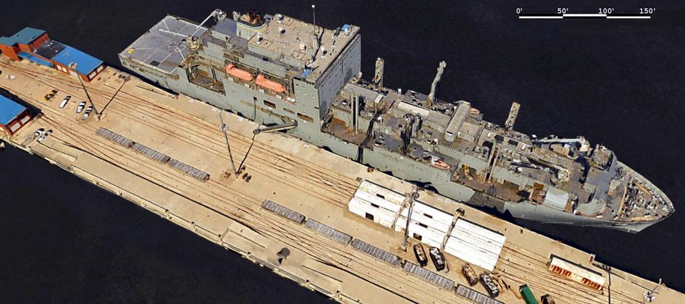
The waterfront complex is the homeport to USS Seattle (AOE 3), USS Detroit (AOE 4), USS Supply (AOE 6), USS Arctic (AOE 8), and Combat Logistics Group 2. Effective June 1, 1997 the USS Supply moved to Earle. Earle provides logistical, technical and material support to the fleet in a variety of areas ranging from combat subsystems and retail ammunition management to ordnance packaging, handling and storage.

Since Earle is a weapons station, it handles, stores, transports, renovates and issues all types of weapons and ammunition. The USS Arctic moved in June 1998. As a result of these decisions, the use of this important facility greatly increased. The Congress noted in 1996 that a parking facility for 60 ordnance loaded trucks is the minimum needed for loading an AOE class ship. Both of the ships subsequently moved to Earle are AOE class ships.
Construction was needed to make the facilities at Earle safer and more efficient through the construction of an Explosive Truck Holding Yards along the waterfront and main side parking facilities. This project (P-245) was originally included in the FY 1994 appropriations bill. in 1996 year the Appropriations Committee included language in its bill that approved a reprogramming request and indicated its support for the construction of these holding yards. Despite the growth of Earle's mission and the support from the Appropriations Committee, this project kept getting pushed back. The Navy budgeted this for FY 1999.

Naval Ammunition Depot Earle commissioned on December 13, 1943
The station - named after RADM Ralph Earle, has two distinct areas. A waterfront location provided ships with a safe and operationally advantageous port to take on ammunition, while an inland storage area, safe from possible submarine bombardment, provided access to commercial rail facilities with lines coming from the west, where the majority of ammunition shipments originated. On August 2, 1943, construction began and in a short time, storage bunkers, a road and rail network, numerous buildings, and a pier complex were built. Named after Rear Admiral Ralph Earle, Chief of the Bureau of Ordnance during World War I, the Station was commissioned on December 13, 1943 as the Naval Ammunition Depot Earle. Earle continued to develop after World War II, keeping pace with the changing needs of the Navy.
The pier stretches 2.2 miles into the Sandy Hook bay and comprises 2.9 miles of pier/trestle surface area. The Station is divided into two sections: Main-side, located in Colts Neck, and the Waterfront Area, on Sandy Hook Bay, located in the Leonardo section of Middletown. Both areas are connected by Normandy road, a 15-mile military road and rail line.
Trestle 1 is the 2 mile long rail and road causeway that leads to Trestles 2, 3 and 4. There are no docking or berthing facilities on Trestle 1.
Trestle 2 leads to Pier 2, and berths 2N1 on the west side and 2N2 on the east side. Berth lengths on Pier 2 are 600 feet with a 500 feet long elevated loading platform on each side of the pier. Pier deck height is 13 feet above MLW, loading platform height is 18 feet above MLW, and the alongside depth is 35 feet at MLW. Pier 2 is not currently used for cargo loading.
Trestle 3 leads to Pier 3 and berths 3A3 and 3A1 (west side), and 3A4 and 3A2 (east side). Total berth length is 1200 feet long with two 500 feet elevated loading platforms on each side of the pier. Pier deck height is 12 feet above MLW, loading platform height is 17 feet above MLW, and the alongside depth is 35 feet at MLW. A small boat mooring area is located in the southeast end of Trestle 3. Tugs and yard craft are moored in this location.
Trestle 4 leads to Pier 4 and berths 4W (west side) and 4E (east side). Berth length is 800 ft with a 600 ft long elevated loading platform on each side of the pier. Pier deck height is 13 feet above MLW, loading platform height is 18 feet above MLW, and the alongside depth is 45 feet at MLW. Pier 4 is the primary cargo-loading pier. A project to improve fendering on Pier 4 was completed by 2001.
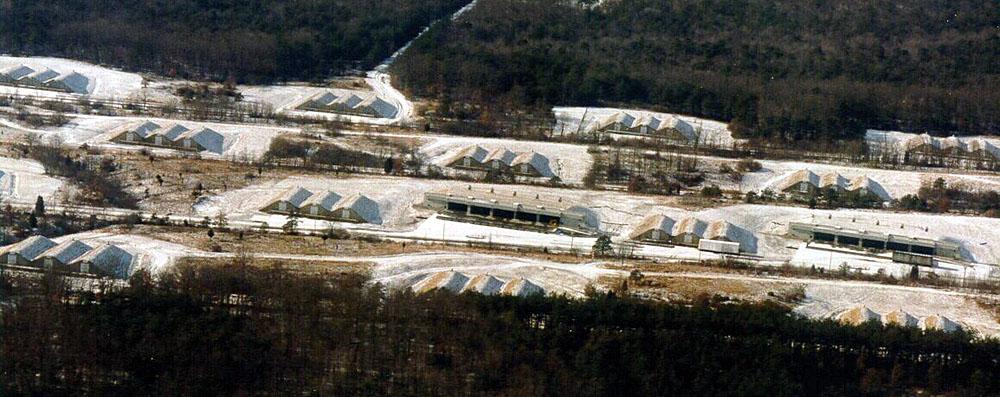
The Main side area, which is located mainly in Colts Neck, is more than 10,000 acres which contains ordnance storage areas and the majority of Earle's departments and facilities. Main side is in many ways like a small town with its own police and fire departments, homes, office buildings, restaurants, and recreational facilities.